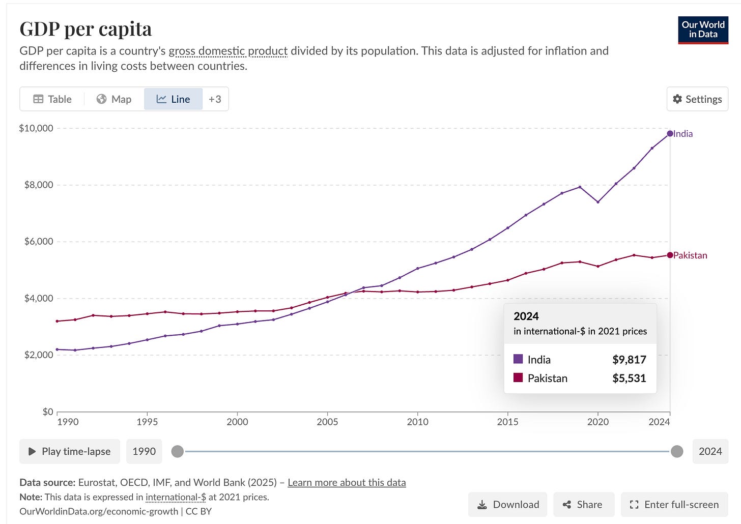
India vs. Pakistan in one graph

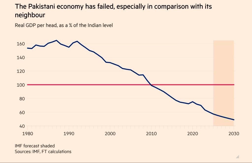
However, total GDP isn’t the right comparison. More populous economies will usually produce more output. GDP per capita is the correct metric to consider. Until 2009, India was poorer than Pakistan on a per capita basis. India truly became richer than Pakistan after 2009 and since then it hasn’t looked back. If trends continue for a decade, India will be more than twice as rich as Pakistan soon.
Image

Pakistan’s GDP is about $400 billion while India’s is around $4 trillion. Since the ratio of their economies has stayed roughly constant for decades, their nominal growth rates should be similar from the 1960s onwards.

So why has India pulled ahead in GDP per capita? The reason is simple. Pakistan’s high fertility has driven population growth faster than India’s. In 1952 Pakistan had about one-tenth of India’s population; by 2025 it had grown to nearly one-seventh.
 

The other explanation why Pakistan finds it easier to maintain the status quo is that it is located in a geopolitically sweet spot. It can extract geopolitical rents from the US. It’s location close to Afghanistan is strategically important and the US has used many Pakistani airbase.


Thanks 0M for the article.
The Muslim Districts That Hold West Bengal Up

West Bengal Hindus have a real grievance, and it should be stated plainly. East Bengal’s Hindu share fell from 28% in 1941 to under 8% in the 2022 Bangladesh census. West Bengal’s Muslim share rose from 19.85% in 1951 to 27% in the 2011 Census, and is estimated higher today.

The Nehru–Liaquat Pact of 1950 was meant to be reciprocal. It was not. One side kept its minorities; the other did not. Three refugee waves, 1950, 1964, 1971, landed on West Bengal alone. The frustration is not communal; it is actuarial.

But the conclusion drawn from it is often wrong. The three Muslim-majority border districts, Murshidabad, Malda, Uttar Dinajpur, are not a demographic problem to be solved. They are the reason the state functions.

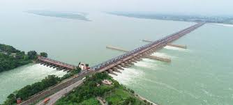
Murshidabad holds the Bhagirathi offtake at Jangipur and the Farakka Barrage beyond it. Farakka diverts the Ganga’s dry-season flow into the Hooghly; without that diversion, Kolkata Port silts up, the Hooghly becomes seasonal, and the salinity line marches inland into the 24 Parganas. Malda anchors the Sealdah–New Jalpaiguri trunk line and the rail spine to Assam; lose it and North Bengal is an island.

Uttar Dinajpur sits directly below the Siliguri Corridor and carries NH 27. These were not given to India by accident in 1947. Radcliffe overrode demography for infrastructure, and the engineering logic has only deepened since.

The Muslims of these districts are weavers, beedi workers, masons, farmers on the most fertile alluvium in eastern India. Murshidabad silk, Malda mangoes, the Farakka catchment; the productive base of three districts rests on a workforce the state would struggle to replace at scale.

Frustration is fair. Cession is not. The districts that look like the problem are the ones holding the system together.

Brown Pundits